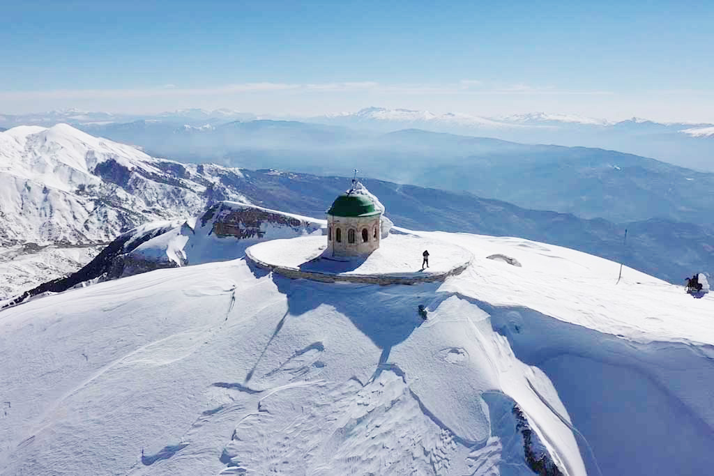
The best known mountain in Albania because it has a religious significance...
Average Reviews
Description
Summary: Tomorri is probably the best known mountain in Albania. It has religious significance, and there is a shrine on the (lower) south summit, also called Mali i Kurbanit or Mali i Babait. The south summit is separated from the higher north summit – called Cuka Partizan – by a 10 kilometer long ridge. The ridge is difficult and the best way to reach the Cuka Partizan is to climb it from the north side.
Maximum altitude: 2416 meter
Minimum altitude: 1007 meter
Cumulative height: 1449 meter
Cumulative length: 8.07 kilometer one way
Difficulty:: difficult
Time: 5.5 hours up
Mount Tomorri can be seen from far away, as long as the visibility is good and the summit is not shrouded in clouds.
Many ambitious hikers may have wondered how to get to the summit. Not so the shepherds who seem to travel to the Cuka Partizan sometimes. There is a trail to the summit, but this is nevertheless a tough hike. The path crosses steep gravel slopes and often talus. Most importantly, more than 1450 Meter elevation gain have to be overcome from the trailhead, and the distance to be travelled is 8 kilometer onew way.
The Drive: To say it upfront: this is not a shortcut from Gramsh to Berat. The trail leads from Gramsh to the village of Sotire, then to the village of Dardhë, on to the trailhead for climbing Tomorri Mountain (Cuka Partizan), and on to the asphalt road near Berat.
Sotire is in Gramsh Region and Dardhë in Berat Region. Typically, rural roads connecting villages of different regions go through no-man’s-land and are in poor repair.
Before we undertook this route, we enquired with people from Gramsh whether there was a road from Sotire to Dhardë, and they maintained there was none. In Gramsh itself, we asked the furgon drivers. They said a furgon (minibus) goes up to Sotire, and a Pajero taxi to the next village when so requested by the three families living there. They had heard about the road continuing to the reservoirs, but there the knowledge ends. They offered their cellphone numbers in case we would get stuck, and re-assured us that tractors are in the area, who would pull us out of misery if needed.
We had seen a track on google earth and gave it a try. We rate the middle part of the trail as very difficult. We didn’t encounter a massive problem, but the trail was in perfectly dry conditon. Just a little rain may get you stuck for a while. The track is not used by lorries, and can be overgrown and narrow, with little escape to either side.
In summary: the trail from the bridge across the Devoll river to Sotire is easy. From Sotire to Dardhë is very difficult. From Dardhë to the trailhead is moderate (you can skip this if you don’t intend to climb the mountain). From Dardhë to Berat it is easy.